Paraguayan Pantanal · Alto Paraguay
Biodiversity of the Pantanal
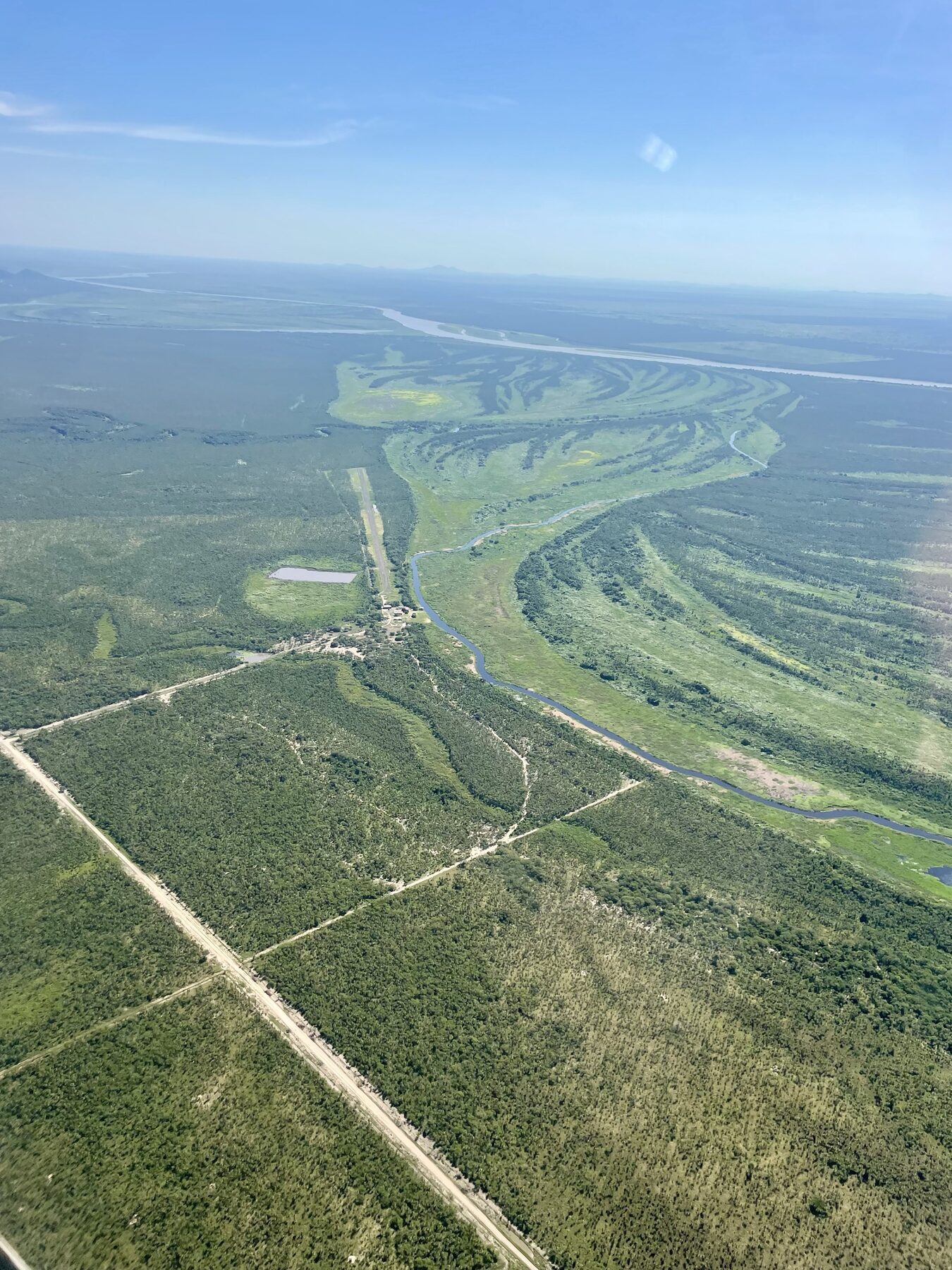
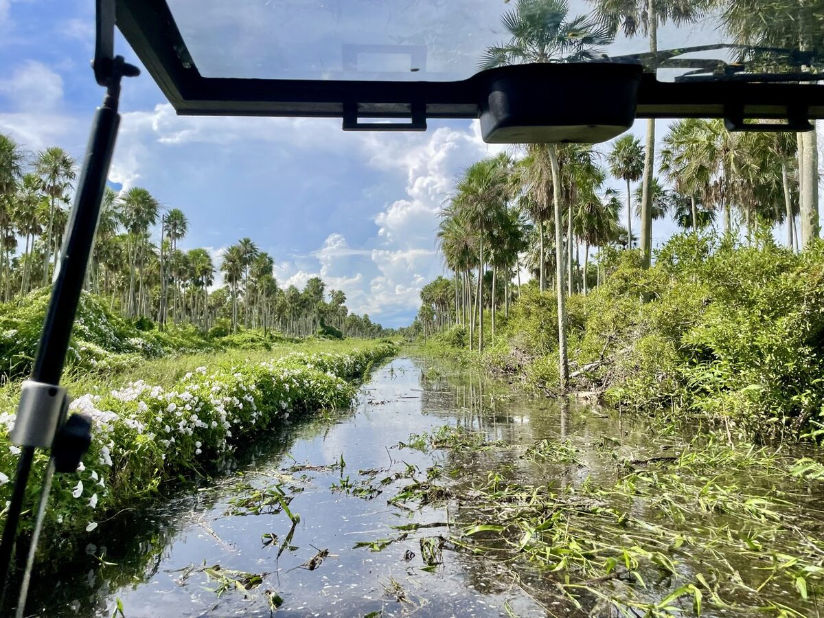
On the bank of the Paraguay River, in the transition between the Pantanal and the Humid Chaco, the property forms part of the largest tropical freshwater wetland on the planet. It is a land of exceptional wildlife —apex predators, large threatened mammals and a birdlife that gathers more than half of the country's bird species— and a key node on the migratory route of the Paraguay-Paraná system. Here, to conserve is also to create value: carbon, biodiversity and low-impact ecotourism.
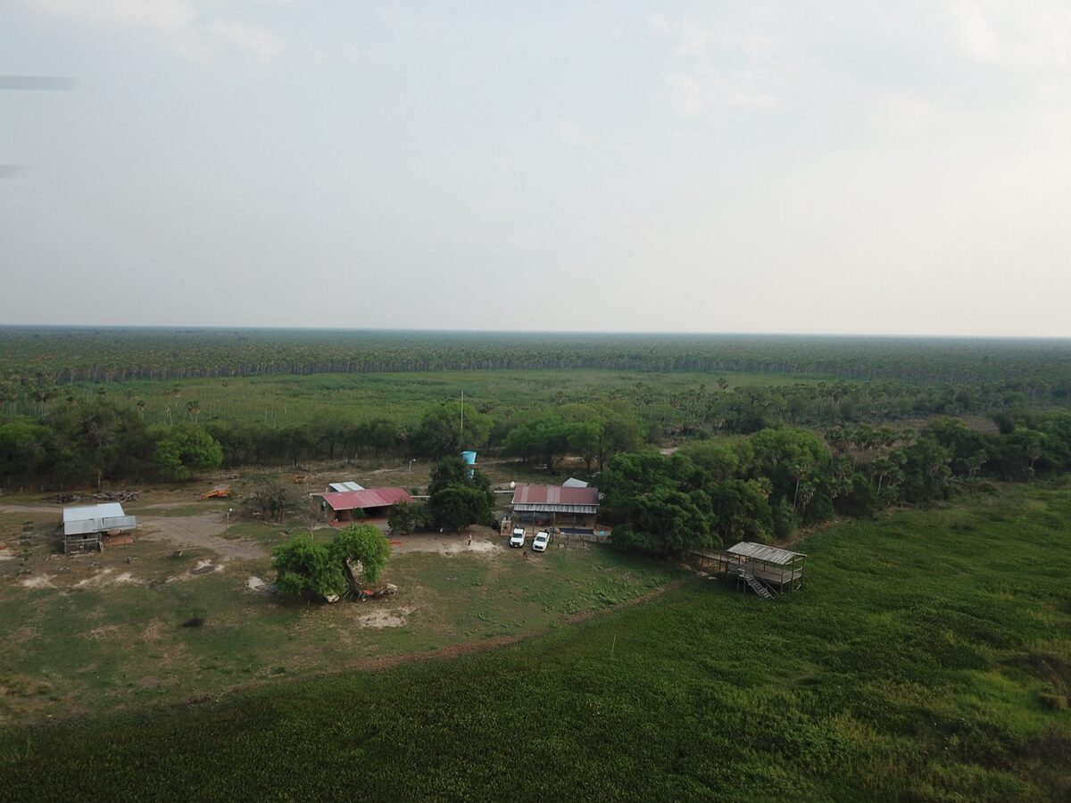
7,686 hectares on the Paraguay River, in the Pantanal–Humid Chaco transition (Fuerte Olimpo, Alto Paraguay).
The Pantanal is the largest tropical freshwater wetland in the world; its Paraguayan portion covers some 15,000 km² in Alto Paraguay.
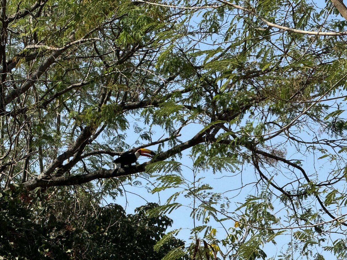
354 bird species recorded in the Paraguayan Pantanal, 71 of them of high conservation priority; more than 50% of the country's birds are concentrated in the wetland area.
The Pantanal biome is home to nearly 2,000 types of plants, 582 birds, 132 mammals, 113 reptiles and 41 amphibians (WWF).
Conservation designations along the corridor: Ramsar Site (since 1995), Chaco Biosphere Reserve (UNESCO-MAB) and Río Negro National Park (123,786 ha); the Paraguayan Pantanal is on UNESCO's World Heritage Tentative List.
The 2020 fires consumed more than 4 million hectares of the Pantanal (~26% of the biome) and released some 115 million tonnes of CO₂: stored carbon is released when the wetland degrades.
Birds
Jabiru / Tuyuyú
Jabiru mycteria
LCThe largest stork in the Americas and an emblematic bird of the Pantanal; the region holds one of its largest populations in the world.
Southern Screamer / Chajá
Chauna torquata
LCA sentinel bird of the marshes: large, loud and unmistakable in the wetlands of the Paraguay River.
Greater Rhea / Ñandú
Rhea americana
NTThe largest flightless bird in South America; it roams the grasslands and savannas of the Pantanal–Chaco transition.
Yellow-billed Cardinal
Paroaria capitata
LCConspicuous and abundant along the banks of the Paraguay River, in marshes and shorelines.
Blaze-winged Parakeet
Pyrrhura devillei
NTA parakeet that, within Paraguay, is found almost exclusively in the Pantanal and its riverside forests.
Mammals
Jaguar / Yaguareté
Panthera onca
NTApex predator of the Pantanal; documented on the banks of the Paraguay River near Fuerte Olimpo.
Tapir / Anta (Mborevi)
Tapirus terrestris
VUThe largest land mammal in South America, dwelling in the forests and wetlands of the Humid Chaco and the Pantanal.
Marsh Deer (Guasú pukú)
Blastocerus dichotomus
VUThe largest deer in South America, tied to wetlands; an emblematic species of these marshes (CITES Appendix I).
Giant Anteater / Yurumí
Myrmecophaga tridactyla
VUAn unmistakable insectivore of the savannas and woodlands of the Humid Chaco and the Pantanal.
Maned Wolf / Aguará guazú
Chrysocyon brachyurus
NTThe largest canid in South America; it inhabits grasslands and open wetlands.
Giant Armadillo / Tatú carreta
Priodontes maximus
VUThe largest living armadillo; one of the most threatened mammals of the Gran Chaco.
Capybara (Kapi'yva)
Hydrochoerus hydrochaeris
LCThe world's largest rodent, abundant in the wetlands; a key prey of the jaguar and the yellow anaconda.
Reptiles and amphibians
Yacaré Caiman
Caiman yacare
LCThe dominant caiman of the Pantanal and the marshes of the Paraguay River; recovered after decades of hunting thanks to protection.
Yellow Anaconda / Curiyú
Eunectes notaeus
LCThe largest aquatic snake in the region, native to marshes and floodable savannas (CITES Appendix II).
Fish
Dorado (Pirá pytã)
Salminus brasiliensis
LCAn apex predator and migratory fish, emblem of the Paraguay and Paraná rivers and of sport fishing.
Spotted Surubí
Pseudoplatystoma corruscans
NTA large migratory catfish; one of the biggest fish of the Paraguay River.
Wildlife recorded at Estancia Manuela and reference images of the Pantanal's flagship species.
The Paraguay River migratory corridor
The Paraguay River is part of the Migratory Bird Corridor of the Paraguay-Paraná system, documented by Wetlands International: a flyway that links the migratory birds of the northern hemisphere with their wintering grounds in the southern cone, with the Pantanal as the system's principal wetland node. Waterbirds and shorebirds use it as a route and resting place. Among the long-distance migrants is the Buff-breasted Sandpiper (Calidris subruficollis), which breeds in the Arctic tundra and travels the central corridor of South America; the IUCN reclassified it as Vulnerable in 2024. Guyra Paraguay —a partner of BirdLife International— has for more than two decades sustained the monitoring of shorebirds and waterbirds along the Paraguay and Paraná rivers, the scientific basis for the region's recognition as an Important Bird Area.
Neighbours of the Yshir (Ishir) Nation
The district of Fuerte Olimpo is the historical territory of the Ishir —who call themselves Yshir and were formerly known as Chamacoco—, a people of the Zamuco linguistic family. The Yshir Nation brings together nearly 3,500 people in seven communities settled along the bank of the Paraguay River, in the districts of Fuerte Olimpo and Bahía Negra. Two subgroups are distinguished: the Ybytoso, riverside dwellers facing the Pantanal, and the Tomáraho, from the interior woodland, who preserve the ancestral rites and the myth of the Anabsoro with greater integrity. They keep their language, yshyr ahwoso, and their own ritual practices alive, and are recognised as guardians of an environment that forms part of their ancestral territory: of the roughly 3,460,000 hectares mapped in 1932, they today have access to around 54,000. The property embraces that proximity with respect, as part of the cultural and human value of the surroundings.
Virgen Santísima — Ishir (Yshir)
In Fuerte Olimpo; with an Indigenous museum and a display of karanda'y handicrafts.
Karcha Bahlut (14 de Mayo) — Yshir — Ybytoso
Sacred land of the Yshir Nation; home to the first 'Green Museum'.
Puerto Diana (Porh Kac) — Yshir — Ybytoso
A riverside community in Bahía Negra, facing the Brazilian Pantanal.
Puerto Esperanza (Ynichta) — Yshir — Ybytoso
A riverside village on the Paraguay River, in Bahía Negra.
María Elena — Yshir — Tomáraho
The last ~45 Tomáraho families in the country, the most traditional subgroup; on the river, upstream of Fuerte Olimpo.
The property as steward of the Pantanal
With 7,686 hectares on the Paraguay River, the property lies within the Paraguayan portion of the Pantanal —some 15,000 km² in the department of Alto Paraguay— and within the Chaco Biosphere Reserve (UNESCO-MAB), which encompasses the district of Fuerte Olimpo. Along the same conservation corridor are Río Negro National Park (123,786 ha), the Ramsar Site of the Paraguayan Pantanal (since 1995) and the Los Tres Gigantes Station (14,600 ha). An intact wetland provides irreplaceable ecosystem services —flood regulation, aquifer recharge, water purification and local climate regulation— and stores carbon in its seasonally flooded soils and biomass. The 2020 fires, which consumed more than 4 million hectares of the biome, showed that this carbon is released when the wetland degrades: it is the basis of avoided-carbon value. Keeping the property intact also enables low-impact ecotourism —jaguar and bird watching— compatible with the ecosystem's integrity. In this way, the property can operate as an active steward of the Pantanal, aligning heritage value with conservation.